Robinson-Huron Treaty Signed on September 9, 1850 Treaty #61
Williams Treaties Signed on October 31, 1923 and November 15, 1923
James Bay Treaty Signed on 1905-1906 Treaty #9
Manitoulin Island Treaty Signed on October 6, 1862 Treaty #94
Treaty of Manitowaning Signed on August 9, 1836 Treaty #45
London Township Purchase
Treaty 6
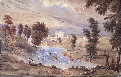
Treaty 6, or the London Township Purchase, was signed on September 7, 1796, by representatives of the Crown and certain Anishinaabe peoples. The territory described in the written treaty is approximately 30 km².
Some of the treaty payments included calico and serge cloths, cooking implements, rifles and flint, and vermillion.
Current communities in the area include the city of London.
Images of the London Township Purchase
Transcript of the London Township Purchase
Chiefs who signed were presented with the Queen Victoria medal. Many of the written treaty terms resemble the written terms of Treaty 3 and Treaty 9, including individual annuity payments and a formula for determining each First Nation’s reserve lands.
Sandy Lake First Nation entered into Treaty 5 in 1910, but their current reserve is located in the territory covered by the Treaty 9 Adhesion.
More information about Treaty 5
Treaty 9 Adhesion
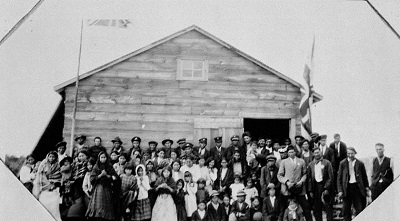
The adhesion to Treaty 9 was signed in 1929 and 1930 by representatives of certain Cree and Anishinaabe peoples and representatives of the Crown. The adhesion to Treaty 9 extends from the Albany River to Hudson Bay.
After the adhesion, Treaty 9 became the largest treaty area in Ontario.
Current communities in the area include over 20 First Nations and the town of Pickle Lake.
Transcript of Treaty 9 Adhesion
Treaty 35
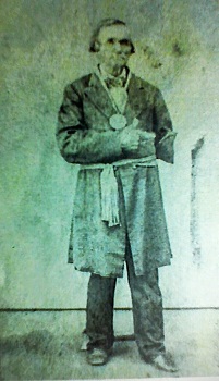
Treaty 35 was signed on August 13, 1833, by representatives of the Crown and the Huron-Wendat.
In the mid-seventeenth century, the Huron-Wendat were displaced from the territory between Lake Ontario, Lake Simcoe, and Georgian Bay after wars with other Indigenous peoples. Some Huron-Wendat moved to Lorette, near Quebec City. Others moved to the west and the south, including this treaty area.
Current communities in the area include LaSalle and Amherstburg.
More information about the Huron-Wendat
Treaty 82
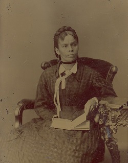
Treaty 82 was signed on February 9, 1857, by representatives of the Crown and certain Anishinaabe peoples. The territory described in the written Treaty is approximately 4,000 hectares, and covers a strip of land north of the contemporary community of Owen Sound.
The representatives of the Chippewas of Newash signed with their clan or "totem" signature.
Notable signatories to this treaty include R.T. Pennefather, Superintendent General of Indian Affairs, and Rev. Peter Jones, a Mississauga chief, author, and Methodist missionary who translated the Bible into Anishinaabemowin.
Current communities in the area include Kemble.
Treaty of Manitowaning
Treaty 45
Treaty 45, or the Manitoulin Island Treaty, was signed on August 9, 1836, by representatives of Upper Canada and certain Anishinaabe peoples. The territory described in the written Treaty covers most of Manitoulin Island and the islands along the north shore of Lake Huron.
Archaeological records provide evidence that Indigenous people lived on Manitoulin Island from 9,000 B.C.E. In 1836, the island became home to many more Indigenous peoples, some of whom had moved from other places in Upper Canada.
Current communities in the territory described by the written Treaty include Little Current and Manitowaning.
Williams Treaties
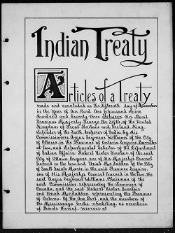
The Williams Treaties were signed on October 31 and November 15, 1923, by seven Anishinaabe First Nations and representatives of the Crown. A commission was established by Canada and led by Treaty Commissioner A.S. Williams to address lands that had not been surrendered via treaty.
The territory covered by the Williams Treaties stretched from the northern shore of Lake Ontario to Lake Nipissing, and together cover approximately 52,000 km². The geography of the Treaties overlaps with several previous treaties.
Current communities in the area include Huntsville and Bracebridge.
Images of the October signing of the Williams Treaties
Transcript of the October signing of the Williams Treaties
Images of the November signing of the Williams Treaties
Transcript of the November signing of the Williams Treaties
Reserves in Ontario
A reserve is an area of land set aside by the federal government for the use and benefit of a First Nation. You can find a full list of reserves in Ontario on the federal government website.
Limitations
This interactive map was designed for illustrative purposes for educators, students, researchers and the general public to gain a sense of Ontario’s treaty history. Treaties and the treaty relationship are more than what is recorded in historical maps. This map and all accompanying materials are not intended to be a complete source of treaty history and do not replace engagement with local Indigenous peoples.
This map does not purport to reflect actual treaty boundaries and is provided for illustrative purposes only. It is not intended to reflect the position of Ontario nor to constitute any admission or limit Ontario’s rights in any way, and should not be relied on to assess legal rights.
A map of the Provisional Algonquin Settlement Area is available on the Algonquin Land Claim page.
This map was created with data used under license from Geobase, Geogratis, the Ontario Realty Corporation, Indigenous and Northern Affairs Canada, and Members of the Ontario Geospatial Data exchange and data held by the Ministry of Indigenous Relations and Reconciliation. The treaty boundaries illustrated for Treaty 3, 1873, Treaty 5, 1875 and Treaty 94, 1862 are those shown on the First Nations and Treaties map produced by the Province of Ontario and the Government of Canada. The treaty boundaries illustrated for areas outside of Ontario are those shown on the Pre-1975 Treaties map produced by the Government of Canada. The remaining treaty boundaries illustrated are based on James L. Morris, Indians of Ontario (Toronto: Dept. of Lands and Forests, 1943).
Converting these maps into a digital map may have resulted in unintentional deviations. For example, Google Maps shows more geographic detail than the printed maps. The Government of Ontario and its ministers, agents and employees disclaim all responsibility for any errors, omissions and inaccuracies in any of these maps, accompanying materials or external links.
No comments:
Post a Comment